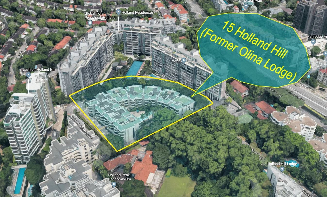
Location Map
Nearby Places
Primary Schools
- New Town Primary School (1.18 km)
- Nanyang Primary School (1.41 km)
- Queenstown Primary School (1.8 km)
- Henry Park Primary School (1.94 km)
- Raffles Girls' Primary School (2.33 km)
Secondary Schools
- Queensway Secondary School (1.14 km)
- St Margaret's Secondary School (1.49 km)
- Fairfield Methodist Secondary School (2.03 km)
- Nanyang Girls' High School (2.25 km)
- JE Educational College (2.35 km)
MRT Stations
- Holland village MRT station (0.5 km)
- Commonwealth MRT station (0.94 km)
- Farrer road MRT station (1.1 km)
- Buona vista MRT station (1.21 km)
- Queenstown MRT station (1.85 km)
Nearest Hospitals & Clinics
- OmniMed Healthcare (0.47 km)
- Raffles Children's Centre (0.49 km)
- Boey@Holland V (0.58 km)
- Tay Medical Centre The (0.68 km)
- Zimmer Pte Ltd (0.92 km)
Parks & Recreation
- Singapore Botanic Gardens Gallop Extension (1.32 km)
- Coronation Park (1.33 km)
- one-north Park (1.4 km)
- Singapore Botanic Gardens (1.75 km)
- Alexandra Park Connector (2.74 km)
Supermarkets
- Sheng Siong (1.05 km)
- Giant Express (1.38 km)
- Cold Storage @ Vista Exchange Green (1.46 km)
- Cold Storage @ Guthrie House (2.3 km)
- FairPrice Finest Artra (2.93 km)
Trains (MRT & LRT)
• HOLLAND VILLAGE MRT CC21 580m
Groceries/ Shopping
• Holland Village Shopping Centre 620m
• The Star Vista 1.41 km
• Rochester Mall 1.46 km
Schools
• New Town Primary 1.09 km
• Nanyang Primary 1.49 km
• Queenstown Primary 1.71 km
• St. Margaret’s Secondary 1.56 km
• Hwa Chong Institution 1.8 km